
Idaho Scenic Byways
Southern Idaho
Central Idaho
Eastern Idaho
Northern Idaho
Southern Idaho Byways

City of Rocks
City of Rocks Backcountry Byway circles part of the Albion Mountain Range passing through historically significant rural landscapes along the way. The route begins in Albion and passes Pomerelle Mountain Resort and Lake Cleveland Recreation Area before ending in Oakley. Highlights include Rocks National Reserve and neighboring Castle Rocks State Park.

Oregon Trail-Bear Lake
Oregon Trail-Bear Lake Scenic Byway winds its way along the turquoise-blue waters of Bear Lake. This lake straddles the Idaho-Utah border and is home to sandy beaches and the famous Bear Lake State Park. The route then travels north through Paris, Montpelier, Soda Springs, Bancroft, Lava Hot Springs, and finally McCammon. Highlights include Minnetonka Cave and historic places on the Oregon Trail.

Snake River Canyon Byway
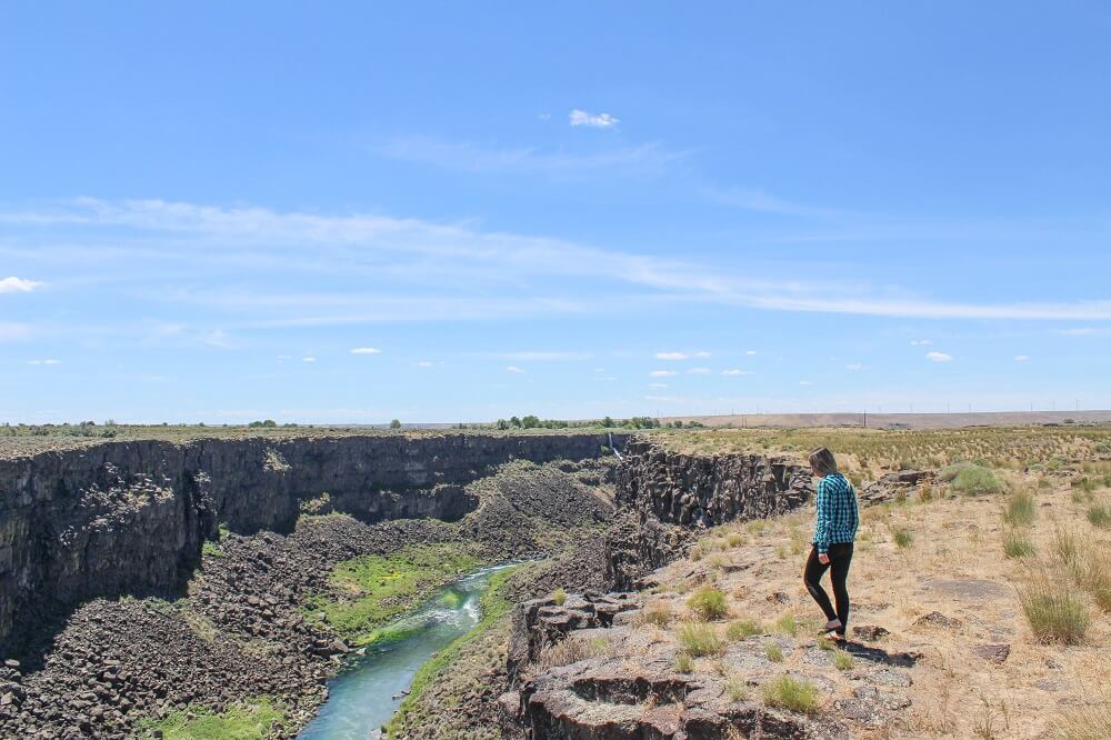
Snake River Canyon Scenic Byway leads through a fascinating landscape born of fire when volcanoes dominated the region and then was reshaped by one of the largest floods in geologic history. Starting in Walters Ferry, the route travels north to Marsing, Homedale, Wilder, Parma, and Nyssa. Explore historical sites and sip your way through the Sunnyslope Wine Trail.

Main Oregon Trail Backcountry Byway
Main Oregon Trail Backcountry Byway follows the route of the pioneers who traveled through the Idaho desert. It begins in Glenn Ferry and heads north to Mountain Home and finally ends at Bonneville Point. Highlights include Three Island Crossing State Park which is home to one of the most challenging river crossings for emigrants along the Oregon Trail

Owyhee Uplands Scenic Byway
Owyhee Uplands Backcountry Byway begins in Grand View not too far from Bruneau Dunes State Park, home of the tallest sand dunes in the United States. The byway then travels southwest to the Jordan Valley in Eastern Oregon. On this journey you will encounter picturesque desert landscapes, juniper woodlands, and the breathtaking Owyhee Mountains.
Thousand Springs Scenic Byway
Distance: 65 miles
Thousand Springs Scenic Byway showcases some of Southern Idaho’s most remarkable geologic wonders! This region is brimming with an abundance of natural springs that gush from steep canyon walls, waterfalls, and hot springs. The route begins near Bliss and follows the Snake River Canyon through quaint small towns all the way to Twin Falls. On this road trip you can visit Thousand Springs State Park, hike, swim, kayak, and soak in hot mineral pools.

Western Heritage Historic Byway
Distance: 40 miles
Western Heritage Historic Byway begins just outside of Boise in Meridian and travels south to Kuna, Celebration Park, and then Swan Falls Dam. On this road trip you’ll visit an archeologic park where you can see petroglyphs and Morley Nelson Snake River Birds of Prey National Conservation Area which is home to the largest concentration of nesting raptors in North America. Add to this breathtaking views of the Owyhee Mountains and the impressive Snake River Canyon, you’ve got yourself one very interesting road trip!

Pioneer Historic Byway
Distance: 114 miles
Pioneer Historic Byway will help you discover Southeastern Idaho’s rugged beauty. The drive begins in Franklin, Idaho’s first city, then follows the Bear River north to Soda Springs where you’ll find the world’s only captive geyser.
Scenic Byways in Central Idaho

Sawtooth Scenic Byway
Distance: 115 miles
The Sawtooth Scenic Byway stretches from Shoshone to Stanley, taking motorists from lava-filled deserts to the towering peaks of the Sawtooth Mountains. Along the way you can visit ice caves, the mountain resort towns of Ketchum and Sun Valley, and finish up at Stanley, an outdoor mecca for hikers, mountain bikers, and fly-fisherman. This is one of the dreamiest road trips in Idaho where visitors can see lushious alpine meadows, clear rivers, and the most beautiful lakes!
Salmon River Scenic Byway
Distance: 160 miles
Salmon River Scenic Byway begins in Stanley and travels north alongside the beautiful Salmon River all the way to the Idaho-Montana border. There are numerous outdoor adventures to be had on this road trip! From hiking to finding secret hot springs, fishing, and visiting ghost towns, this drive has much to offer adventurous souls.

Peaks to Craters Scenic Byway
Distance: 140 miles
Peaks to Craters Scenic Byway is an extraordinary drive will take you on a journey from the jagged mountain peaks of Central Idaho down to the desert lowlands of Southern Idaho. The route starts in Challis and follows the western edge of the Lost River Mountains to Arco. This mountain range is home to the highest peaks in Idaho! End the road trip at Craters of the Moon National Monument where you can explore captivating craters and oceans of lava flows. This is tcertainly the most diverse stretch of road in the Gem State.

Ponderosa Pine Scenic Byway
Distance: 130 miles
Ponderosa Pine Scenic Byway starts in Boise and meanders up Highway 21 north to the historic mining town of Idaho City before continuing onto Lowman where the road veers east to Stanley — a town with a population of 100 people which sits at the base of the spectacular Sawtooth Mountains. This road trip is packed with stunning natural scenery and outdoor adventure!

Wildlife Canyon Scenic Byway
Distance: 35 miles
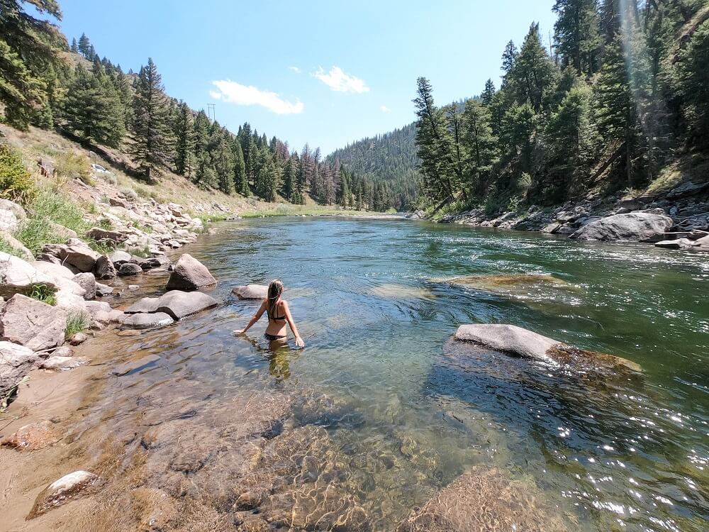
Wildlife Canyon Scenic Byway follows the South Fork of the Payette River from Banks to Lowman. This absolutely stunning drive will take you through some of Central Idaho’s most stunning landscapes including an impressive canyon formed by the turbulent forces of the South Fork of the Payette River, offering plenty of outdoor adventure from whitewater rafting to hiking, fly-fishing, and hot springing along the way! If you’re not ready for the road trip to end, you can continue on Ponderosa Pine Scenic Byway to Stanley.

Payette River Scenic Byway
Distance: 114 miles
Payette River Scenic Byway offers plenty of thrilling whitewater adventures, as well as lakeside and on-lake activities. This road trip begins in Boise and follows the Payette River through the Boise and Payette National Forests. The drive is packed with opportunities to hop out of the car and enjoy rafting, kayaking, boating, fishing, hiking, wildlife, and camping. It’s a road trip that is fun at any time of the year including winter!

Sacajawea Historic Byway
Distance: 135 miles
Sacajawea Historic Byway parallels the Continental Divide for almost 100 miles through some of the most beautiful countryside in Idaho. Beginning in Salmon, the drive runs southeast through the Lemhi River Valley to Gilmore and eventually onto the Snake River Plain. Along the way you can discover the history of local Native Americans by learning about Sacajawea’s story and her impact on the Corps of Discovery and Idaho, experience stories of the Lemhi-Shoshone people, see Native American rock art.

Hells Canyon Scenic Byway
Distance: 62 miles
Hells Canyon Scenic Byway winds its way along a massive rift known as Hells Canyon. Hells Canyon is a legendary destination known for being the deepest gorge in North America, yes it’s even deeper than the Grand Canyon! The drive begins in Cambridge where you might spot bighorn sheep at Cecil D. Andrus Wildlife Management Area, then travels north on Highway 71 to goliath Hells Canyon Dam. While the view from the byway is breathtaking, a guided float trip or jetboat tour is a must to make the most of this road trip.
Scenic Byways in Eastern Idaho

Teton Scenic Byway
Distance: 68 miles
Uncover the unfamiliar side of Grand Teton National Park! Teton Scenic Byway takes motorists on a journey through the majestic Teton Valley where the snowy white spires of the Teton Mountains tower above sweeping rangelands. This drive begins in Swan Valley, a popular fly-fishing destination, then passes through spectacular Caribou-Targhee National Forest over the Big Hole Mountains before descending into Teton Valley. The road then travels through Victor and Driggs, both historic towns where famous fur trappers once held their annual North American Rendezvous in the early 1800s, before continuing north to Ashton where the byway ends.

Fort Henry Scenic Byway
Distance: 90 miles
Fort Henry Scenic Byway offers history with a side of outdoor adventure! This drive will give you a glimpse into the rural beauty of Eastern Idaho, the opportunity to hike or ATV across acres of white quartz sand blown into 400-foot tall dunes at St. Anthony Sand Dunes, try your hand at fly-fishing at renowned spots along the Henry’s Fork of the Snake River, and learn about the Indigenous history of this area.

Lost Gold Loop Trail
Distance: 50 miles
Lost Gold Loop Trail follows an early Gold Rush route beginning in Dubois traveling north to Spencer closely following Beaver Creek towards Montana’s gold mines. Gold in Spencer has disappeared however opals have taken its place, and today you can dig for opals in the area. The byway then heads east to Kilgore crossing Camas Meadows which is home to migrating wildlife, before continuing south to loop back to Dubois via A2 Clark County Road.
Scenic Byways in Northern Idaho

St. Joe River Scenic Byway
Distance: 87 miles
St. Joe River Scenic Byway provides a scenic drive alongside the cottonwood-lined St. Joe River in Northern Idaho. The cottonwood trees are home to numerous Bald eagles and ospreys that feast on trout from the river below. From St. Maries follow St. Joe River Road for 75 miles to Forest Highway 50 where the road then climbs 14 miles to the Idaho-Montana border.

White Pine Scenic Byway
Distance: 80 miles
White Pine Scenic Byway offers views of Idaho’s northern farmlands, mountains, and extensive forests — including the largest stand of White Pine trees in North America. The route begins on Highway 3 near Cataldo where road trippers can visit the famous 1840s Old Mission of the Sacred Heart. Traveling alongside Coeur d’Alene River, the road passes through marshland spotted with numerous lakes before ending in Potlatch, a place that was once home to the world’s largest white pine mill.

Lake Coeur d’Alene Scenic Byway
Distance: 25 miles
Lake Coeur d’Alene Scenic Byway is a short and pretty drive that is a must do for anyone visiting Coeur d’Alene. The byway begins at the junction of Interstate-90 and Highway 97, and follows the lake’s shoreline. It’s beautiful to drive at any time of the year.
Pend Oreille Scenic Byway
Distance: 35 miles
Lake Pend Oreille is Idaho’s largest and deepest lake. The lake sets the route for Pend Oreille Scenic Byway which travels alongside its rocky northern shoreline. The drive, which begins in Sandpoint, is picture-perfect at any time of the year. Delight in alpine vistas, far-reaching forests, and glistening blue water as far as the eye can see.

Wild Horse Trail Scenic Byway
Distance: 36 miles
Wild Horse Trail Scenic Byway starts in Sandpoint on the shores of Lake Pend Oreille where the Selkirk Mountains provide a dramatic backdrop. The route follows the “Wild Horse Trail” which was crucial for the Kootenai Tribe and settlers when this region was growing through the Gold Rush Era. Keep an eye out for wildlife along the byway as you make your way through McArthur Lake Wildlife Corridor toward the historic gold-mining town of Bonners Ferry and the Kootenai National Wildlife Refuge before ending at Porthill, the international border stop to enter Canada.

Panhandle Historic Rivers Passage
Distance: 30 miles
Panhandle Historic Rivers Passage begins at the Washington state line and follows the northern shore of the Pend Oreille River through Oldtown, then Priest River, and ends in Sandpoint. Enjoy soothing river scenery, pastoral beauty, and birdwatching along the drive. This byway is part of the International Selkirk Loop.

International Selkirk Loop
Distance: 89 miles
The International Selkirk Loop is a 280-mile road trip around the Selkirk Mountains of Idaho, Washington and British Columbia. Idaho’s segment of this loop drive connects two scenic byways — Wild Horse Trail Scenic Byway and Panhandle Historic Rivers Passage.

Northwest Passage Scenic Byway
Distance: 202 miles
Northwest Passage Scenic Byway is Idaho’s longest byway. It follows the route Meriwether Lewis and William Clark took through north central Idaho in 1803. What you’ll see on this road trip is magnificent wilderness including rugged mountains, deep canyons, and sparkling rivers. The drive begins in Lewiston and follows Clearwater River Canyon along Highway 12 to the Idaho-Montana border at Lolo Pass.

Gold Rush Historic Byway
Distance: 42 miles
Gold Rush Historic Scenic Byway showcases everchanging landscapes that include rolling fields of grain, endless thick forests, and stunning valleys. The route begins in Greer off Highway 12 and follows Highway 11 through Clearwater National Forest to Pierce where early pioneers discovered gold in Idaho for the first time. Twelve miles north of Pierce is Headquarters which marks the end of the byway.

Elk River Backcountry Byway
Distance: 54 miles
Elk River Backcountry Scenic Byway is an off-the-beaten-path adventure in Northwest Idaho. This scenic drive begins in Orofino off Highway 12 and travels north crossing Idaho’s tallest bridge – the Dent Bridge, and winds its way through the vast evergreen forests of the Clearwater Mountains to Elk River. There’s plenty of opportunities for hiking, biking, fishing, wildlife viewing, and camping along the way.