6 Best Hikes in Pinnacles National Park for Views and Adventure
Pinnacles National Park may be one of California’s smaller national parks, but it packs a punch when it comes to hiking! With dramatic rock spires, awesome talus caves, and panoramic ridgeline views, this park offers a variety of trails for outdoor enthusiasts. Whether you’re looking for a challenging climb or a scenic stroll, these are six of the best hikes in Pinnacles National Park for epic views and unforgettable adventure.


Pinnacles National Park is one of the smallest and least-visited parks in the U.S. national park system, tucked away in an often-overlooked part of Central California. But don’t let its size or remote location fool you—Pinnacles is an incredibly exciting and unique destination for hikers!
The park’s fascinating landscape was formed by volcanic activity some 23 million years ago, and its dramatic rock formations are remnants of an extinct volcano. Unlike the granite found in other California parks like Yosemite and Joshua Tree, Pinnacles’ striking cliffs and spires are made of colorful volcanic breccia in shades of yellow, orange, and cream.
Spanning more than 26,000 acres, this national park is set in a sunny, oak-studded landscape, home to Blue Oaks, Live Oaks, and other native vegetation.
But the real standout feature at Pinnacles National Park is its Talus Caves—underground passages formed by boulders collapsing into narrow canyons over millions of years. These caves are open for hiking in fall, winter, and spring, offering a one-of-a-kind adventure.
With more than 30 miles of hiking trails ranging from easy loops to strenuous climbs, there’s something here for everyone. From crawling through caves and scrambling over boulders to ridge-top hikes with panoramic views, Pinnacles offers an adventurous and scenic experience for all types of hikers.
The good news is that many of the trails intersect, making it easy to combine multiple hikes in a single day—and since the park is relatively small, you can realistically explore every trail in just two to three days!
Ready to hit the trail? Here are six of the best hikes in Pinnacles National Park for scenic views and unforgettable adventure!
Best Hikes in Pinnacles National Park
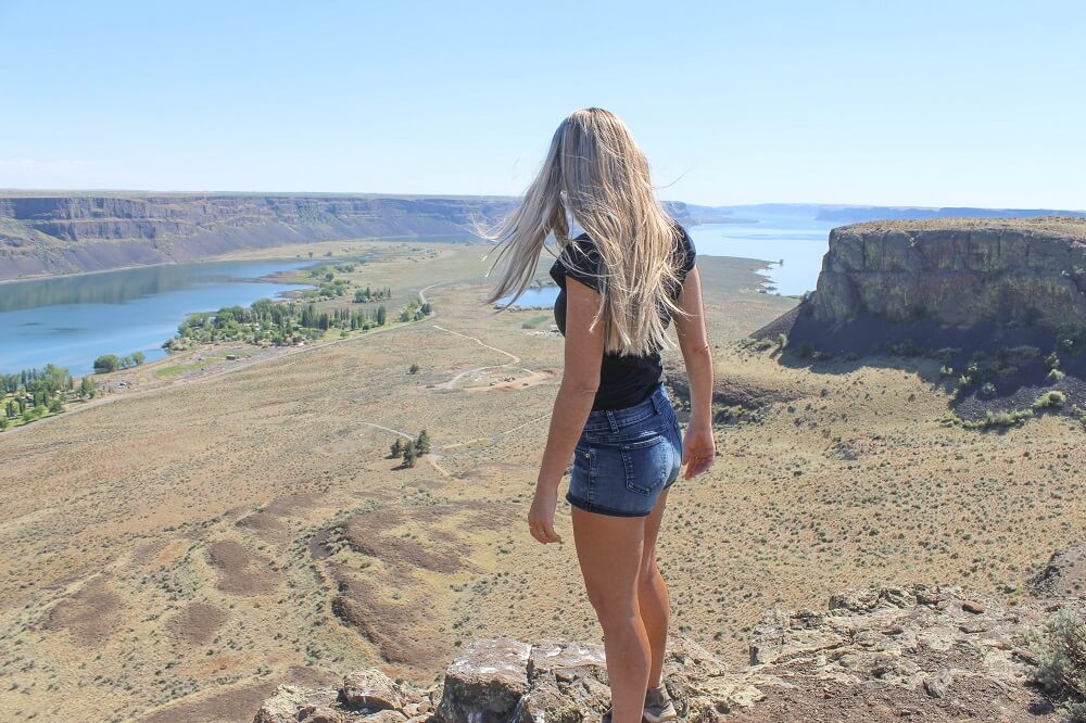
1. Prewett Point Trail

The Prewett Point Trail is the shortest and easiest hike at Pinnacles National Park, ideal for beginner hikers or anyone short on time. It’s also wheelchair accessible and stroller friendly thanks to its flat, hardened surface.
This trail begins at the West Visitor Contact Station and leads to an overlook with panoramic views of the High Peaks, Balconies Cliffs, and the surrounding countryside.
From the Visitor Center, follow the five-foot-wide compacted trail as it winds through an open field. Along the way you might spot wild turkeys or deer grazing in the field. As you continue, the rugged High Peaks will gradually come into view, and on a clear day, you can even spot the fire tower atop North Chalone Peak.
At a junction along the trail, continue straight instead of turning right to reach the overlook, where you’ll enjoy sweeping vistas of the High Peaks and Balconies Cliffs.
Benches along the trail provide perfect spots to rest and soak in the scenery. While you’re resting, don’t forget to look up—you might catch a glimpse of California condors soaring overhead.
To return, complete the short loop back to the Visitor Center. If you’re up for more hiking, you can continue onto the Jawbone Trail which leads downhill to the Jawbone Parking Area, but if you take this alternate route, you’ll need to hike back the same way or walk along the road to return.
2. Balconies Cave Trail

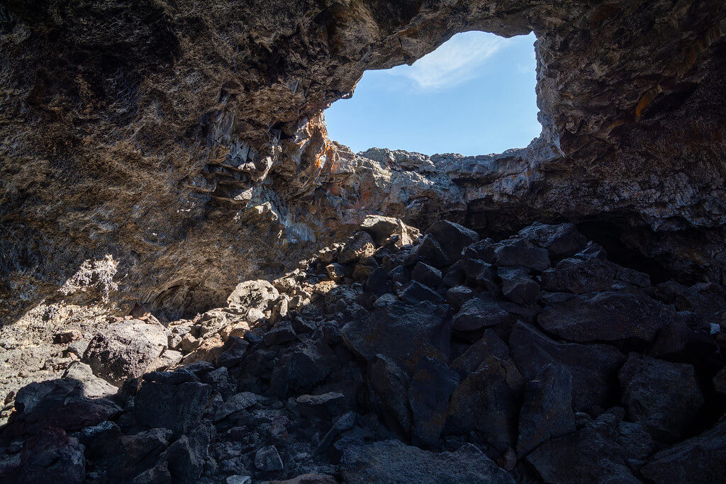
Balconies Cave Trail is easily one of the most exciting hikes in Pinnacles National Park, offering a unique adventure through one of the park’s most fascinating features—its talus caves!
Rated as a moderate hike, this trail takes you into Balconies Cave, where you’ll twist, turn, and navigate your way through tight squeezes and large, dark passages.
Talus caves like this are formed when massive boulders tumble into narrow chasms, creating a maze-like system of caverns. Typically found in mountainous regions with rocky outcrops of granite, gneiss, or other fractured rock, talus caves are a rare feature primarily seen across the western U.S. and parts of the Appalachian region.
To start your adventure, park at the Chaparral Parking Area and follow the trail for about 0.6 miles until you reach the cave entrance. The cave section itself is relatively short, just 0.4 miles, so if anyone in your group is nervous about the dark, reassure them that you’ll be back in the daylight in no time.
From there, you can either return the same way for a simple two mile out-and-back hike, or if you’re up for a bit more exploration take the Balconies Cliffs Trail on the way back. This alternate route leads above the caves for a bird’s-eye view of the striking rock formations and involves a light elevation gain.
The Balconies Cave Trail is most easily accessed from the park’s west entrance, but you can also reach it from the east side via the Old Pinnacles Trailhead, which makes for a 3.8-mile round trip.
For those looking for a longer adventure, consider the epic Old Pinnacles–Balconies Cave–High Peaks–Blue Oak Trail loop, totaling about 6.5 miles.
Whichever route you choose, be sure to bring a flashlight—portions of the cave can be pitch-black. In wetter months, be prepared for some wading as water can collect inside the caves after rain.
3. Bear Gulch Cave Trail

The Bear Gulch Cave Trail is one of the best hikes in Pinnacles National Park! This iconic trail is a fun and easy hike that takes you through one of the park’s talus caves.
Begin your adventure at the Moses Spring Parking Area, where you’ll pick up the trail at the Moses Spring Trailhead. From there, it’s a 0.7-mile walk through a shaded canyon lined with oak trees before you reach the entrance to Bear Gulch Cave—where the real fun begins!
Step into the darkness and navigate your way through narrow crevices and larger open chambers. On the other side of the cave, you’ll find a steep stone staircase carved into the rocks. Climb up, and you’ll be greeted by a surprising sight; a tranquil reservoir surrounded by rugged rock formations.


The reservoir is especially photogenic at sunrise and sunset. We happened to visit during golden hour, and the glow on the water and surrounding cliffs was magical. A fun fact: Bear Gulch Reservoir is also home to the threatened California red-legged frog, a protected species.
When you’re ready to head back, you have a few options. You can return the way you came—either back through the cave or along a parallel trail that bypasses it. For a slightly different route, consider taking the Rim Trail, a short 0.4-mile path that offers elevated views as it loops back toward the trailhead.
Keep in mind that Bear Gulch Cave is home to a colony of Townsend’s big-eared bats, another protected species. Because of this, the cave is closed seasonally (typically May through July) while the bats raise their young. If it’s closed during your visit, you can still enjoy the hike—just take the bypass trail next to the cave.
4. Bear Gulch Reservoir via the Rim Trail

The hike to Bear Gulch Reservoir begins at the Moses Spring Trailhead, which is the same starting point for the Bear Gulch Cave Trail. However, when you reach the junction, you’ll take the Rim Trail instead. This route involves a bit of elevation gain but rewards you with beautiful views along the way.
If you have the time, take a moment to walk around the reservoir or relax on one of the surrounding rocks to enjoy the peaceful scenery. Just note that swimming and drinking from the reservoir are not allowed.
It’s less than a mile one way to reach the reservoir, and you can return the same way or loop back via the trail that runs through Bear Gulch Cave. During summer when the caves are typically closed, you can take the trail that runs alongside the cave (without going through it).
5. High Peaks Trail

The High Peaks Loop Trail is a moderate to strenuous hike that plunges you deep into the park’s rugged interior. Along the way, you’ll encounter steep climbs, breathtaking overlooks, and a series of rock-carved steps with handrails that guide you safely across exposed sections.
This is one of the park’s most iconic hikes, offering a thrilling journey through towering rock formations, narrow ridgelines, and some of the most dramatic scenery in Central California.
One of the standout moments of the hike is the aptly named “Steep and Narrow” section, where stone-carved steps and metal handrails lead you across a dramatic ridgeline with sweeping panoramic views. This exhilarating stretch is both a physical challenge and a highlight of the entire trail.


As you make your way through the High Peaks, keep an eye on the skies—Pinnacles is home to one of the largest populations of endangered California condors, and you might just spot one soaring overhead.
There are several ways to hike the High Peaks Loop Trail. From the east entrance you can start at the Condor Gulch Trail and finish at the Moses Spring Trail, or start at the Old Pinnacles Trailhead and return via Blue Oak Trail.
From the west entrance, you’ll begin this hike on the Juniper Canyon Trail. Learn more about the different ways to hike this trail here.
6. Chalone Peak Trail

The hike to Chalone Peak is the longest and most challenging trail in Pinnacles National Park, leading to the park’s highest point—North Chalone Peak. From the summit, you’ll be rewarded with sweeping panoramic views of the surrounding valleys.
Begin your hike at the Moses Spring Trailhead and follow the trail through Bear Gulch Cave to Bear Gulch Reservoir. From the reservoir, look for a signpost marking the start of the official trail to Chalone Peak.
Along the way, you’ll come across two fences that you’ll need to climb over to stay on the trail. Don’t skip them—trying to go around can easily get you off route and bushwhacking through dense brush. The second fence is roughly a mile from the summit, so once you reach it, you’re almost there.
The climb gets a bit steep in places, but it’s manageable if you pace yourself. Take your time, and before you know it, you’ll reach the top! For those with extra energy, you can continue 1.6 miles past the summit on an unmaintained path to South Chalone Peak.
Keep in mind that this trail is completely exposed, with little to no shade. Even in winter, it can be sunny and warm, so bring plenty of water, sunscreen, and a few snacks.
It takes a little over two hours to reach the summit, and slightly less on the way back. To change up the scenery, consider returning via the Rim Trail.
Tips for hiking in Pinnacles National Park

1. Start early to beat the heat
Pinnacles National Park can get very hot between late spring through early fall. Daytime temperatures often soar above 90°F. Begin your hikes early in the morning to avoid the worst heat and enjoy cooler, more comfortable conditions.
2. Bring plenty of water
The dry, sunny landscape will dehydrate you quickly. Always carry more water than you think you’ll need—especially on longer, strenuous hikes. Check out these sleek hydroflasks if you’re in the market for a new water bottle.
3. Wear grippy footwear
Many trails at Pinnacles include steep sections, loose gravel, rocky scrambles, and even cave floors that can be slippery. Good hiking shoes or boots with solid traction are highly recommended.
4. Carry a headlamp for cave hikes
If you’re planning to explore Bear Gulch or Balconies Caves, be sure to bring a headlamp or flashlight because the caves are pitch black in places. Rangers recommend using a headlamp (like this one) so your hands are free to help with balance as you navigate through the narrow passages.
5. Check cave closures in advance
The Talus Caves are often closed in summer to protect bat populations. Visit the NPS website for current cave status before you go.
6. Watch for poison oak
Poison oak grows throughout the park, often along trail edges. Wearing long pants can help reduce your chances of a rash.
7. Bring binoculars for condor spotting
Pinnacles National Park is one of the best places in the country to spot California Condors. Keep your eyes on the sky, especially along high ridges. Bring binoculars (like these lightweight, highly-rated ones) that are perfect for wildlife viewing opportunities.
8. Don’t expect cell service
Cell reception is very limited to nonexistent in the park. Download maps and trail info ahead of time and consider using a GPS app like AllTrails or Gaia for offline navigation.
9. Plan parking wisely
Pinnacles has two separate entrances: East and West, and they are not connected by a road through the park. Be sure to choose the right entrance for your planned hikes, and arrive early on weekends as parking fills up fast.
Where to stay near Pinnacles National Park
Camping at Pinnacles National Park
There is a campground at the east entrance of Pinnacles National Park that is open year-round. RV sites have hookups while tent sites have a picnic table and fire ring. A general store with food and camping supplies is located onsite and open from 9.30am to 5pm.
Unlike other national park campgrounds, this one has a pool to help you cool off during the hot summer months. It is open from April 1st to September 30th. Campsites can be reserved up to six months in advance here.
Hotels near Pinnacles National Park
Unfortunately hotels near the park are limited. If you plan to visit the west entrance, Inn at the Pinnacles and the Motel 6 in Soledad are the closest options.
For stays near the east entrance, the closest lodging options are in Hollister which is about 30 miles away. Top picks here include Holiday Inn Express, Fairfield Inn & Suites and SureStay by Best Western.
If you’re looking to treat yourself and don’t mind a slightly longer drive, consider the Posada de San Juan, located in the charming historic district of San Juan Bautista. This boutique hotel features spacious rooms, cozy fireplaces, and luxurious jetted bathtubs.
Here is a table with a list of every trail in the park to help with your trip planning.
Overview Of Hikes in Pinnacles National Park
| Trail Name | Difficulty | Distance | Elevation |
| Prewett Point Trail | Easy | 0.9 mile | 78 ft |
| Jawbone Trail | Easy | 2.4 miles | 100 ft |
| Balconies Caves-Cliffs Loop | Easy | 2.4 miles | 100 ft |
| Moses Spring to Bear Gulch Cave | Easy | 1.4 miles | 311 ft |
| Bear Gulch Reservoir via Rim Trail | Moderate | 2.2 miles | 500 ft |
| Condor Gulch to High Peaks Loop | Strenuous | 5.3 miles | 1300ft |
| High Peaks and Bear Gulch Loop | Strenuous | 6.7 miles | 1425 ft |
| Old Pinnacles to Balconies Cave | Moderate | 3.4 miles | 0 feet |
| Old Pinnacles to Balconies Cave – High Peaks – Blue Oak Trail | Strenuous | 7.9 miles | 1425 ft |
| Chalone Peak Trail | Strenuous | 8 miles | 2040 ft |
| South Chalone Peak | Strenuous | 11.2 miles | 2040 |
| North Wilderness Loop | Moderate | 9.5 miles | 1220 ft |

PINNACLES NATIONAL PARK
Planning a visit? Check out our complete Pinnacles National Park travel guide featuring top things to do, best times to visit, where to stay, and more!

PINNACLES National Park
Planning a visit? Check out our complete Pinnacles National Park travel guide featuring top things to do, best times to visit, where to stay, and more!
Looking for a place to stay near the park? Use the interactive map below to find hotels, motels, and other lodging near Pinnacles National Park.