
Coulee Corridor Scenic Byway: Best Stops Between Tri-Cities & Omak
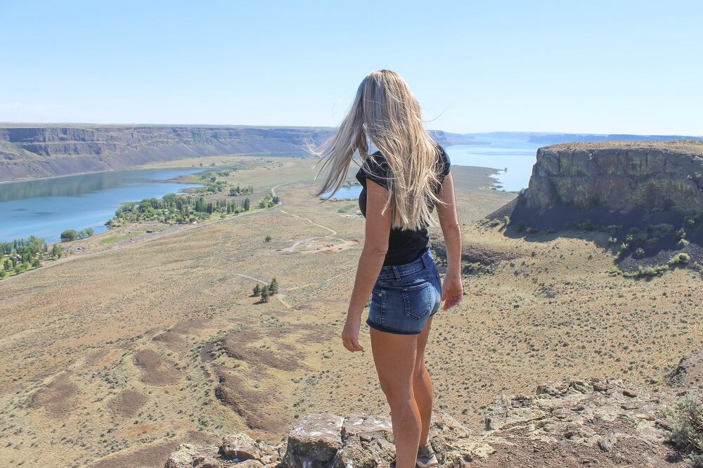
Coulee Corridor Scenic Byway is a splendid route that showcases landscape carved out by Ice Age Floods. On this drive you’ll travel through geologically unique terrain and see wide canyons, towering buttes, ancient caves, and deep blue lakes.

Coulee Corridor Scenic Byway Summary
Where to begin-end this road trip: Start this road trip in Tri-Cities, Washington. Head north on Highway 395 to Highway 17 where Coulee Corridor Scenic Byway officially begins. Follow Highway 17 north through Columbia River Gorge to Highway 155 and continue north to Omak where the byway ends.

Coulee Corridor Scenic Byway will take you on a road trip through the Columbia Basin, Grand Coulee, and Lake Roosevelt National Recreation Area, offering dramatic views of geologically unique terrain.
Key stops along the byway include Lake Lenore Caves, Dry Falls, Banks Lake, and Grand Coulee Dam, one of the largest concrete structures in the United States.
There is also some opportunity for hiking, fishing, and wildlife watching. Bird enthusiasts should note that more than half of Washington state’s 346 bird species can be found along this route. Here is a guide to bird species found in the Coulee Corridor.
So you might be wondering what is a coulee? The term “coulee” refers to a deep, steep-walled canyon formed by ancient glacial floodwaters, and on this you’ll pass through some of the most striking examples of these landforms.
Although the byway officially begins in Moses Lake, the best place to start the drive is in Tri-Cities since it’s one of the largest cities in Eastern Washington and has an airport. However if you are coming from Spokane start the road trip in Othello or Moses Lake.
From Tri-Cities follow Highway 395 north and take the exit for Highway 17 where Coulee Corridor Scenic Byway officially begins. Travel north on this road to Sun Lakes Dry Falls State Park where you’ll then need to take Highway 155 to the byway’s end which finishes at the foothills of the Cascade Mountains in Omak.
Best stops on Coulee Corridor Scenic Byway
1 Soap Lake

First stop after leaving Tri-Cities is Soap Lake. This lake was extremely foamy once upon a time and famous for its miraculous healing waters. It was even dubbed “the world’s greatest mineral sea” and “Washington’s health resort” in the early 1900s. Folks from all over the state really would flock here to heal themselves in Soap Lake’s legendary waters.
This was all due to the lake’s high mineral content. The lake’s waters boast over 23 minerals including sulfur, magnesium, and calcium, which provide health benefits for skin conditions, arthritis, and other ailments.
These days the lake isn’t very soapy at all. In fact, even the lake’s high mineral content has been drastically reduced since the construction of a canal that now channels the water upstream.
Nevertheless, some visitors still have faith in Soap Lake’s healing properties. They continue to come during the warmer months to bathe in the lake’s non-soapy waters.
Do you want to test the water’s therapeutic properties out for yourself? You can access Soap Lake from its southern end where you’ll find a gravel beach and small picnic area complete with covered picnic tables.


Alternatively, book a stay at Soap Lake Natural Spa & Resort where you can enjoy the healing attributes of Soap Lake from the privacy of your own room. Each room at this property features a two-person jacuzzi with mineral water pumped directly from the lake!
You’ll also have access to a private beach, mud baths, saunas, outdoor hot tub, and watercraft rentals. Learn more here.
There is another resort on the northern end of the lake — Smokiam RV Resort & Campground. It offers private cabins, as well as lakeside teepees complete with private deck and fire pit. If you’re looking for a unique experience you should check this place out!
>>Read: 8 Unique Things To Do in Soap Lake, Washington
2 Lake Lenore Caves

Continuing north, Coulee Corridor Scenic Byway enters an impressive gorge with high vertical walls. This gorge is part of the lower coulee and is home to Lenore Lake, a large but narrow lake that was formed by the Missoula Floods.
The byway runs alongside this lake and at the far northern end is where you’ll find Lenore Caves, a set of seven ancient caves hiding in the cliffs above. These caves were also created by the Missoula Floods when the rushing water pulled chunks of basalt from the walls of the cliffs.
The caves are fun to explore and hiking to them will give you a reason to get out of the car and explore this unique part of the country. There are also terrific views of the gorge and lake from the high vantage point so don’t forget to take your camera with you.


Directions: To get to the caves keep an eye out for the sign to Lake Lenore Caves Trailhead. From the trailhead hike along a short trail to reach the caves. See this trail guide on hiking to Lake Lenore Caves.
3 Sun Lakes Dry Falls State Park

Sun Lakes Dry Falls State Park, located in the heart of Washington’s Coulee Corridor, offers a glimpse into the power of ancient Ice Age floods. The “Glacial Lake Missoula Floods” carved out this landscape 15,000 years ago when a massive ice dam in Montana ruptured sending a torrent of water westward at speeds of 60-miles per hour. This rushing water scoured the land reshaping this entire region of the Pacific Northwest.
The most impressive feature at the park is Dry Falls, a now dry waterfall (hence the name) that was once the largest waterfall in North America! Although the falls is no longer active, the colossal cliff face is still very cool to see.
To get the best view of the amazing natural wonder stay on Highway 17 and find the parking lot for Dry Falls Visitor Center which is actually past the entrance into the park. Here you’ll find an overlook which provides sweeping views of the ancient waterfall and Dry Falls Lake.


If you have time, head into Sun Lakes Dry Falls State Park and visit the three beautiful lakes within its boundaries; Blue Lake, Park Lake, Dry Lake, and Deep Lake. Inside the park you’ll find canoe, kayak, and water tractor rentals if you want to get out on the water.
Be sure not to miss seeing Umatilla Rock, the park’s unmistakable landmark which you can take a short hike around. Learn more about hiking and water activities at Sun Lake Dry Falls State Park.
4 Steamboat Rock State Park

Steamboat Rock State Park is one of the most impressive, interesting, and unique places in Eastern Washington! Not only is it a stunning destination, and unlike any other in the evergreen state, but it’s also a terrific location to enjoy all sorts of outdoor activities!
This 3,522 acre state park is home to massive Banks Lake. This deep blue lake stretches for 27-miles and is well known for its excellent fishing. Smallmouth Bass, Walleye, and Lake Whitefish are the most popular species to fish but Rainbow Trout and Kokanee can also be caught here. During most winters the lake freezes over providing a popular ice fishery for anglers.
But you don’t have to be a fisherman to enjoy Banks Lake. There are several calm and protected areas to put in a kayak or paddleboard, as well as sandy beaches perfect for swimming.
The park was named after a huge basalt butte that rises up from the middle of the lake named Steamboat Rock. If you’re up for a challenge you can hike to the top of Steamboat Rock to see panoramic views of the park and beyond. Even the Cascade Mountains can be seen from the top of the butte!
Steamboat Rock State Park is one of the top attractions on this driving itinerary so plan to set aside a few hours for visiting. There are several lakeside picnic areas located under the shade of tall Poplar trees. Don’t forget to bring a packed lunch!
The park is also a great spot to break up the road trip especially if you’re traveling in an RV or campervan because there are developed camping facilities here. It is a popular camping destination in summer so be sure to book your stay in advance if you are visiting on the weekend.
>>Read: Steamboat Rock State Park: A Perfect Summer Camping Destination in Eastern Washington
5 Grand Coulee Dam
The main attraction in Grand Coulee is the Grand Coulee Dam, America’s largest concrete dam. There is a visitors center at the dam open between 9am and 5pm where you’ll find exhibits and information about the history of the dam. You can also watch a short film about its construction.
If you don’t have time to spend at the Visitor Center you can have a quick look at it from either above or below the dam where you’ll find a pull-out on the side of the road.
Note: There is a decent grocery store in Grand Coulee so if you’re in need of snacks this is the place to load up! It is a one hour drive from Grand Coulee to Omak through Colville National Forest.
6 Omak

Omak, which is less than an hour south of the United States-Canadian border, is the largest town in this northwest corner of Washington state. Although with less than 5,000 residents it’s really not that big of a place.
Every year on the second weekend of August, Omak’s population balloons to 30,000 people when the World Famous Stampede Rodeo and Suicide Race is held. The event is jam-packed with western entertainment including an Indian Encampment & Pow Wow. During the Suicide Race, horses and riders run down Suicide Hill, a 62-degree slope, to the Okanagon River which they swim across and then make a dash to the finish line. It’s an event that is most definitely worth planning a trip around!
The Omak Visitor Information Center has free brochures and maps that will help you discover some of the attractions you can visit in or near Omak.

One of the top attractions is Okanogan County Historical Museum. Inside the museum are exhibits and historical photos that tell the Okanogan story from early geologic to modern times. Outside the museum is a replica of an Old West town complete with a saloon, post office, barber, and blacksmith shop. There is even a replica of an old Okanogan Fire Station complete with vintage fire engine.
Just outside of Omak there are plenty of places to go hiking, mountain biking, swimming, boating, fishing, and camping. Anglers should head to Omak Lake which has been stocked with cutthroat trout. Sinlahekin Wildlife Area is the place to go for hiking, wildlife viewing, and camping.
Where to stay in Omak: Omak is the last stop on this road trip. If you plan to stay overnight book a room at the Best Western Peppertree Inn or 12 Tribes Omak Casino Hotel (the latter has an RV park). See more hotels in Omak here.


